

Written by Lindsay Addison, Coastal Biologist
Tara and I have been combing through five years of shorebird surveys and doing some data checking and tidying up. In itself, this is not a scintillating task, but in entering and checking our banded bird data, we've found some cool pieces of information. One example is the travelog of a Red Knot carrying a light green flag that reads U3N. This bird belongs to a species of world-class migrants, some of whom find their way from the southern reaches of Chile and Argentina to the Canadian tundra every year for the duration of their 20-plus year lifespans.
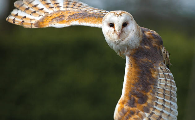
The fat, light gray bird on the left is a Red Knot. Like U3N, it's wearing a light green flag, which is just visible peeking out from its belly. By Lindsay Addison
Red Knots and other shorebirds make these incredible journeys as a matter of course, but people only get to know about them through a combination of luck and hard work. Thanks to the online database BandedBirds.org, I could report U3N and learn that it began its banded odyssey on May 20, 2008 at Moores Beach, NJ, where it was captured and banded by researchers. It was next seen seven months later December 3, 2008 in Tierra del Fuego, Chile, over 6,000 miles away. Amazingly, it was seen again on July 27, 2009 in James Bay, Ontario. It was seen stopping over in New Jersey and Virginia in the spring of 2010 and 2011, and then on May 19, 2012 I ran across it on Lea-Hutaff Island, an IBA in southeast North Carolina. It must have gotten refueled, because two days later it showed up in Mispillion Harbor, DE. Whether it made it to Canada again is unknown, but by this past September it had returned to South America, this time to Lagoa do Peixe National Park on the southern coast of Brazil.
The band resightings tell part of the story, but there are gaps, such as the summer of 2008, when U3N probably was in northern Ontario but no observer read its band. Recently geolocators--small devices that pinpoint their locations by measuring daylight at known times--have been attached to Red Knot bands to complete the picture. Geolocators pinpoint additional stopover sites and show how long it took the birds make those jumps from Chile, to Brazil, to North Carolina, to Ontario. As BandedBirds.org describes here, geolocators reveal other Red Knots taking a similar route to U3N's. For instance, one Red Knot covered the 5,000 miles from a pit stop in southern Brazil to the coast of North Carolina in 6 days without stopping--I would have a hard time driving I-40 from my office in Wilmington to Bartow, CA and back in the same amount of time, though the distance is almost identical. Red Knots perform these feats by gorging themselves on fattening food like horseshoe crab eggs. Once fueled up, they shut down their digestive systems, to the point of partially digesting their own stomachs, and take advantage of favorable weather conditions if possible.
By themselves, the sightings of U3N are a great gee-whiz story, but taken together with other birds' data, they help scientists studying knots piece together a bigger picture of the places the birds depend on and their needs for the future. Individuals and organizations can help add pieces to the puzzle by looking for and reporting banded birds.

